Tidal movements are a captivating natural phenomenon, orchestrated by the celestial pull of the Moon and the Sun on our ocean’s waters.
The magnitude of the tides can be amplified or diminished by the unique characteristics of regional geographies and various atmospheric conditions.
These factors interplay to present a dynamic range of tidal experiences, from minor changes barely noticeable to locals to dramatic fluctuations that captivate visitors and researchers alike.
Key Takeaways
5. Rio Gallegos, Argentina
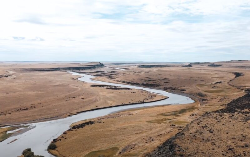
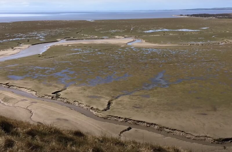
The Gallegos River, a prominent waterway in Santa Cruz, Argentina, originates from the southern regions of Chile and makes its way northward to meet the western Atlantic Ocean.
In the Southern Hemisphere, Rio Gallegos distinguishes itself by exhibiting the highest average tidal range. Here, tides typically soar to heights of 8.8 meters or 29 feet, symbolizing the area’s remarkable aquatic dynamics.
This exceptional tidal phenomenon is largely attributed to the river’s shorelines and the configuration of its estuary. The confluence of the river’s eastward current with the westbound Atlantic waters at the river’s mouth, enhanced by a narrowing landform, produces these extraordinary tidal heights. The result is a remarkable display of nature’s forces where the tidal waters converge.
Cook Inlet Tidal Phenomena
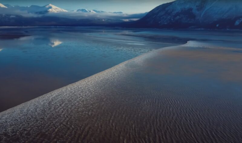
Location: South-central Alaska
Length: 180 miles (Anchorage to the Gulf of Alaska)
Water Sources: Knik, Little Susitna, Susitna, Matanuska Rivers
Cook Inlet stands out for having the United States’ most extreme tide ranges. The Turnagain Arm area, situated south of Anchorage, witnesses the inlet’s peak tidal measures, averaging 30.3 feet, or approximately 9.2 meters.
- Mean Tidal Range: 30.3 feet (9.2 meters)
- Excess Heights: Tides over 25 feet are common
The unique interplay between the Turnagain Arm’s natural resonance and the funnel-shaped passage that directs tides from the Gulf of Alaska results in pronounced water movements. These movements give rise to the inlet’s characteristic high tidal phenomena. The region’s geography, inclusive of several volcanic landforms, adds to the dynamic tectonic activity in the area, which historically has led to tsunamis and seismic events.
3. Bristol Channel, UK

- Location: Divides South Wales from South West England
- Extent: From River Severn’s mouth to the North Atlantic
- Significant City: Bristol, a major port city
Bristol Channel is notable for its extreme tidal range, with Port of Avonmouth observing an impressive average high tide of 31.5 feet (9.6 meters). During periods of low tide, extensive mud flats are exposed, transforming the landscape.
The channel’s exceptional tidal movements are in part due to the continental shelf lying offshore, which acts as a funnel for the Atlantic swell into the narrower confines of the channel. Consequently, the inrush of water generates significant ocean swells.
Navigating these waters is challenging due to the powerful tides. Nonetheless, these conditions foster a vibrant scene for various watersports, including surfing, windsurfing, and sailing, which thrive on the channel’s dynamic environment.
2. Ungava Bay, Canada
- Location: Divides northern Quebec and Baffin Island, Canada
- Tidal Range: Average height of 9.8 meters (32 feet)
- Maximum Tides: Up to approximately 17 meters (56 feet) by the Leaf River during spring
- Climate: Ice prevalent; summer temperatures average 7°C (45°F)
Notable Features:
- Shallow Arctic Ocean marginal sea
- Formed by a meteoric impact
- Renowned for significant tidal variations due to geographical and natural factors
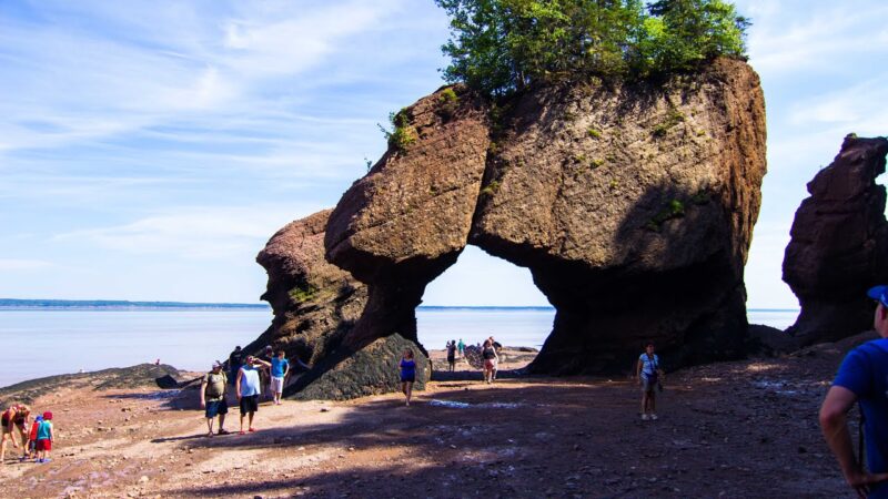
1. Bay of Fundy, Canada
Situated between New Brunswick and Nova Scotia, part of the Gulf of Maine, opening to the Atlantic Ocean.
Remarkable Tidal Activity:
- Tidal Range: Approximately 11.7 meters (38.4 feet), the most extensive globally.
- Natural Design: The bay’s unique funnel shape synergizes with sea resonance to magnify the tidal effect.
- Water Movement: Immense volumes, with hundreds of billions of tons, flow daily, affecting the bay and its tributaries.
The Bay of Fundy is renowned for its powerful tides which even reverse the flow of water in rivers leading into it, showcasing one of nature’s most dynamic and spectacular marine movements.
Factors Influencing Oceanic High Tides
Gravitational interactions between the Earth and the Moon primarily dictate the occurrence of high tides. Every day, the rotation of the Earth results in two periods of elevated water levels known as high tides along its coastlines. These high tides, approximately 12 hours and 25 minutes apart, coincide with the Moon’s position overhead and its antipodal point on the Earth’s surface.
Tidal Mechanics:
- Frequency: Earth experiences high tides roughly every 12 hours 25 minutes.
- Transition: It takes about 6 hours and 12.5 minutes for water levels to switch from high to low tide or the reverse.
- Gravitational Bulge: High tide aligns with places on Earth’s surface directly under or opposite the Moon.
Local geographical features also amplify tidal effects. The configuration of the land, along with the seafloor’s topography, often acts like a funnel channeling the water, thus intensifying the height of the tides in those regions. Areas with certain underwater landscapes and coastal shapes can experience significantly higher average tides due to these combined factors.
Measurement Techniques
Tide monitoring has evolved significantly with technological advancements. Historically, measurements were taken manually with the assistance of tide houses. These structures were equipped with tide staffs externally and an intricate system of a well and pen-and-ink analog recorders internally to track the ebb and flow of tides.
Modern tide stations have largely transitioned to electronic gauges and acoustic-sounding tubes. These contemporary methods not only ascertain tidal heights but also gather comprehensive data on oceanographic variables including:
- Wind direction
- Water currents
- Temperature
- Barometric pressure
These stations transmit the data to databases where it is stored and made accessible.
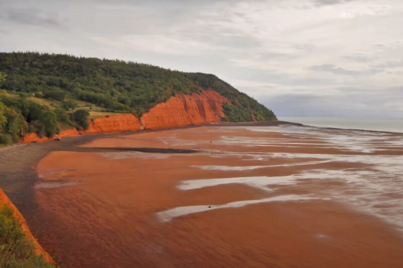
Largest Recorded Tide in History
In October 1869, Hants County’s Burntcoat Head experienced an unparalleled tidal event. A powerful storm surge, resulting from a tropical cyclone known as the Saxby Gale, combined with the region’s spring tides to elevate sea levels dramatically. This confluence of natural events culminated in a record-breaking tide height of 70.9 feet at the eastern extent of the Bay of Fundy.
Exploration of Earth’s Strongest Oceanic Pulses
- Bay of Fundy, Canada: Tops the charts with a remarkable 38.4-foot tidal range.
- Ungava Bay, Canada: Witnesses tides surging to impressive heights of 32 feet.
- Bristol Channel, UK: The tides here swell up to a noteworthy 31.5 feet.
- Cook Inlet, United States: Sea levels rise significantly here, reaching 30.3 feet.
- Rio Gallegos, Argentina: Rounding out the top five with substantial tides measuring 29 feet.
Frequently Asked Questions
What Are Locations with the Most Extreme Tides?
Known for experiencing the monumental movement of water, the Bay of Fundy in Canada claims the record for the highest tides on Earth. In the United States, Turnagain Arm near Anchorage, Alaska, is also recognized for its significant tidal variations.
Notable Bays and Estuaries for Tidal Ranges?
Multiple bays and estuaries across the globe are celebrated for their dramatically shifting tides. These include, but are not limited to, the Severn Estuary in the UK, Ungava Bay in Canada, and the Cook Inlet in Alaska.
What is Record-Breaking Tide Measurement?
The highest recorded tide was documented in the Bay of Fundy, where the water level can rise up to an astounding 16 meters (approximately 53 feet).
Reasons for Exceptional Tidal Heights?
Some coastal regions exhibit unusually high tides due to several factors such as the shape of the bay, resonant amplification that occurs when the frequency of incoming tides matches the natural frequency of the bay, and the alignment of the Sun, Earth, and Moon.
Comparative Tidal Extremes in the Bay of Fundy?
When compared to other regions with significant tides, the Bay of Fundy stands out. Its unique funnel shape and vast tidal range eclipse the tidal variations seen in most other places with high tides.
Geological Influences on the Highest Tides?
The world’s highest tides are often shaped by specific geological features including:
- The funnel-like geometries of bays and estuaries
- The large size of the tidal basin
- The unique seabed topography
These factors interact to enhance the tidal range, culminating in the remarkable natural phenomena observed in areas like the Bay of Fundy.
Conclusion
The celestial dynamics between the Earth, Moon, and Sun, coupled with unique geographical features, orchestrate the world’s most extreme tidal phenomena.
Regions like the Bay of Fundy, Ungava Bay, Bristol Channel, Cook Inlet, and Rio Gallegos showcase the astonishing power and beauty of nature through their remarkable tidal ranges.
These areas not only provide valuable insights into the interplay between oceanic and astronomical forces but also highlight the importance of understanding tides for coastal management, navigation, and environmental preservation.
As we continue to explore and study these natural wonders, they remind us of the dynamic planet we inhabit and the complex systems that govern it.